Dr. Satiprasad Sahoo
Consultant (Water Resource Engineer), International Center for Agricultural Research in the Dry Areas (ICARDA)

My research interest lies in fields of remote sensing, geographic information system, groundwater prospects and recharge zone mapping, watershed monitoring and development, effect of climate change, identification of critical reaches, environmental impact assessment.
Bio Sketch
Web of Science: https://apps.webofknowledge.com
Scopus: https://www.scopus.com/authid/detail.uri authorId=56417182700
Google Scholar: https://scholar.google.co.in/citations
Linkedin: https://in.linkedin.com/pub/satiprasad-sahoo/31/b08/a22
Researchgate:https://www.researchgate.net/profile/Satiprasad_Sahoo
Orcid: http://orcid.org/0000-0002-6490-7432Orcid
Education for the development of critical moral consciousness
.................Dr. Elena Mustakova-Possardt

Hard work isn’t enough to succeed in today’s world
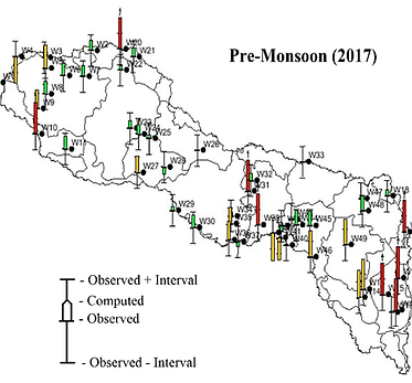
Dwarakeswar-Gandheswari River Basin
Pules suitability
(eight districts of
West Bengal)
EXPERIENCE

Professional Experience
Founder & Director (Apl, 2024 - Present) in the Prajukti Research Pvt. Ltd., Baruipur, West Bengal, India.
Consultant (Water Resource Engineer) (Mar, 2023 - Present) in the International Center for Agricultural Research in the Dry Areas (ICARDA), Egypt.
Assistant Professor (Jun, 2022 - June, 2023) in the International Institute of Geospatial Science & Technology (IIGST), South Asian Institute for Advanced Research and Development (SAIARD), Kolkata, West Bengal.
Consultant (Aug, 2022 - Dec, 2022) in the International Center for Agricultural Research in the Dry Areas (ICARDA), Egypt.
Subject Matter Expert (Water Resource Engineer) (Oct, 2021 - Mar, 2022) in the Vassar Labs IT Solutions Pvt Ltd, Hyderabad, Telangana.
Guest Faculty (Apl, 2021 - Dec, 2021) in the Department of Geography, Jadavpur University.
Postdoctoral Researcher (Aug, 2020 - Feb, 2021) in the School of Ecology and Environment Studies, Nalanda University, India.
Postdoctoral Researcher (Aug, 2019 - Dec, 2019) in the Centre for Environment of Indian Institute of Technology Guwahati, India
Project Officer (Jun, 2016 - Mar, 2019) in the School of Water Resources, Indian Institute of Technology Kharagpur, India
GIS Consultant (Jan, 2013 - Dec, 2015) of IWMP Project by Department of Land Resources, Ministry of Rural Development, Govt. of India
Project Assistant (May, 2013 - Jun, 2016) in the Department of Civil Engineering, Indian Institute of Technology Kharagpur, India
Project Title: Integrated Watershed Management Programme
Sponsored: Ministry of Rural Development (Govt. of India)
Undertaken: Department of Land Resources
EDUCATION

School of Ecology and Environment Studies
Bihar, Rajgir
Duration: 2020 - 2021
Thesis: Aquifer characterization, artificial recharge and reuse of suddenly available water in South Bihar
Advisor: Dr Prabhakar Sharma, Assistant Professor, School of Ecology & Environment Studies, Nalanda University
Postdoctoral Researcher
Postdoctoral Researcher
Centre for Environment
Indian Institute of Technology Guwahati
Guwahati, Assam
Duration: 2019 - 2019
Thesis: Climate Change of Manipur
Advisor: Dr Anamika Barua, Professor, Department of Humanities and Social Sciences, Indian Institute of Technology Guwahati
Doctor of Philosophy
Department of Civil Engineering under Faculty of Interdisciplinary Studies, Law & Management
Kolkata, West Bengal
Duration: 2017 -2019
Thesis: Impact of Climate Change and Anthropogenic Interventions on Hydro-Environmental Regime of Dwarakeswar-Gandheswari River Basin
Advisor: Dr. Anupam Debsarkar, Professor, Department. of Civil Engineering, JU & Dr. Anirban Dhar, Professor, Department. of Civil Engineering, IIT Kharagpur
M.S by Research
School of Water Resources
IIT-Kgp (Indian Institute of Technology Kharagpur)
Kharagpur, West Bengal
Duration: 2013 - 2016
Thesis: Evaluating the Effectiveness of Methods for Identification of Groundwater Potential, Vulnerability and Environmental Vulnerability Zones
Advisor: Dr. Anirban Dhar, Professor, Department. of Civil Engineering, IIT Kharagpur
Master of Science
Master of Science
Department of Remote Sensing & GIS
Vidyasagar University, Midnapore, West Bengal
Duration: 2009 - 2011
Dissertation Remote Sensing & GIS Application for Hydrological Modeling of Lower Ganga River Basin
Advisor: Dr. Anirban Dhar, Professor, Department. of Civil Engineering, IIT Kharagpur
Bachelor of Science
Postdoctoral Researcher
Centre for Environment
Indian Institute of Technology Guwahati
Guwahati, Assam
Duration: 2019 - 2019
Doctor of Philosophy
Department of Civil Engineering under Faculty of Interdisciplinary Studies, Law & Management
Kolkata, West Bengal
Duration: 2017 -2019
M.S by Research
School of Water Resources
IIT-Kgp (Indian Institute of Technology Kharagpur)
Kharagpur, West Bengal
Duration: 2013 - 2016
Thesis: Evaluating the Effectiveness of Methods for Identification of Groundwater Potential, Vulnerability and Environmental Vulnerability Zones
Advisor: Dr. Anirban Dhar, Associate Professor, Department. of Civil Engineering, IIT Kharagpur
Master of Science
Master of Science
Department of Remote Sensing & GIS
Vidyasagar University, Midnapore, West Bengal
Duration: 2009 - 2011
Thesis: Remote Sensing & GIS Application for Hydrological Modeling of Lower Ganga River Basin
Advisor: Dr. Anirban Dhar, Associate Professor, Department. of Civil Engineering, IIT Kharagpur
Bachelor of Science
1. Best Young Scientist Award, 2020, International Academic and Research Excellence Awards (IARE)


SKILLS

Arc GIS, QGIS, ERDAS Imagine, ENVI, PCI Geomatica
Dyna Clue (CLUE Model) and MOLUSCE (MOLUSCE)
Statistical DownScaling Model (SDSM)
J2000 (Hydrological Model)
MATLAB (MATLAB)
EXPERTISE
Dyna Clue Modeling

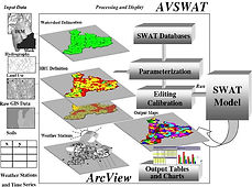
SWAT Modeling
Geospatial Analysis
-
Essential GIS concepts to field studies
-
Determine land use/land cover changes
-
Irrigation water management
-
Urban Planning
-
Soil Mapping
-
Land Information System
-
Wetland Mapping
-
GIS Applications in Geology
-
Measuring soil moisture content
-
Deforestation
Groundwater Hydrology
-
Grey-AHP based groundwater potential zone mapping
-
DRASTIC based groundwater vulnerability mapping
-
Groundwater quality mapping
-
Observing groundwater activities in well
-
GRACE
-
MODFLOW
-
ASR
Geomorphology
-
Identification of critical reaches
Climate Change
-
Futuristic Climate Change Scenarios
-
Observing climate changes
Integrated Water Resources Management (IWRM)
-
WEAP
Overlay Method

Field Verification
Surface Water Modeling
-
Remote Sensing & GIS based Surface Water Modeling (ArcSWAT, ArcHydro, HEC- HMS, HEC-RAS, HEC-GeoHMS, J2000)
Environmental Impact Assessment
-
Grey-AHP based environmental vulnerability mapping
-
GIS and Sustainability Planning
